GPS Survey
The GPS Survey tool is used to survey a vineyard or orchard with a high-accuracy GPS receiver. Surveys are used to build and update the robot's map in the Map Editor.
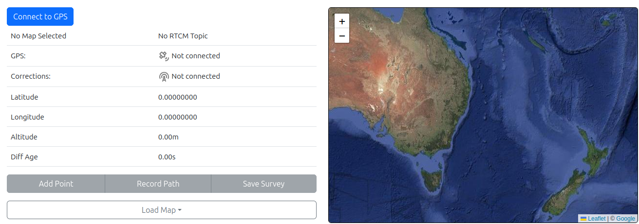
A survey can contain two types of data:
| Type | Used for |
|---|---|
| Points | Recording individual locations, usually the ends of rows. |
| Paths | Recording a continuous route, which can later be used as a corridor for the robot to follow. |
To open the tool, select Tools > GPS Survey.
The control panel shows the status of your GPS and corrections, the buttons for collecting and saving data, and the Load map button.
Connecting to the GPS
- Click Connect to GPS. Your device's Bluetooth (BLE) connection window opens.
- Select your GPS receiver: either the BiNav or the AB GPS device.
Once connected, the control panel shows two status indicators:
| Indicator | Shows |
|---|---|
| GPS | The current GPS fix state. |
| Corrections | Whether GPS corrections are being received. |
Loading Corrections
The app supplies GPS corrections for your farm. To start receiving them:
- Click Load map.
- Select the map for the farm you are surveying.
When both the GPS and Corrections indicators turn green and show Fix, you are ready to start surveying. This can take a short time after the map is loaded.
Wait for a fix
Do not start recording until both indicators show Fix. Points and paths recorded without a fix will not have the accuracy needed for the robot's map.
Recording Points
Stand at the location you want to record and click Add point. The current location is added to your survey as a point.
Recording Paths
- Click Record path. The tool continuously records your position as you move.
- Walk the route you want the robot to follow.
- Click Record path again to finish the path.
Paths are useful wherever the robot needs to follow a precise route, such as:
- Along a headland.
- Through a tight corridor, for example over a waterway.
- Across a bridge. Walk along the exact centre so the robot's corridor keeps it well clear of the edges.
Tip
The robot follows the path you walk, so walk it the way you want the robot to drive it. Keep to the centre of narrow corridors and avoid detours.
Saving a Survey
Click Save survey to upload the survey to the Autonabit server. The message Survey saved confirms that the server has accepted it.
You can keep surveying after saving. Click Save survey again at any time to update the survey on the server with your new points and paths.
Alternative: Surveying with SW Maps
SW Maps is a GIS data collection app for Android and iOS. It can be used instead of the GPS Survey tool, and produces surveys that can be used in the Map Editor in the same way.
SW Maps is useful because it supports a wider range of GPS receivers. It can connect over:
- USB
- Standard Bluetooth
- Bluetooth Low Energy (BLE), as used by the Autonabit receivers
Surveying with SW Maps
- Create a new survey project in SW Maps.
- Connect SW Maps to your GPS receiver.
- Connect to your local reference station for corrections by entering its connection credentials.
- Create a new layer, then record points and paths as described in Recording Points and Recording Paths.
- When the survey is complete, export the project as GeoJSON.
- Transfer the GeoJSON file to your computer.
The GeoJSON file can then be imported into the Map Editor, where it is used in the same way as a survey from the GPS Survey tool.
Reference station details
If you are unsure which reference station to connect to, or need its connection credentials, contact Autonabit support.
Configure Bynav M8-X1
Configure the NMEA Rates
To configure NMEA message rates download ByCenter for Android.
-
Install and Launch the ByConnect software on an android phone
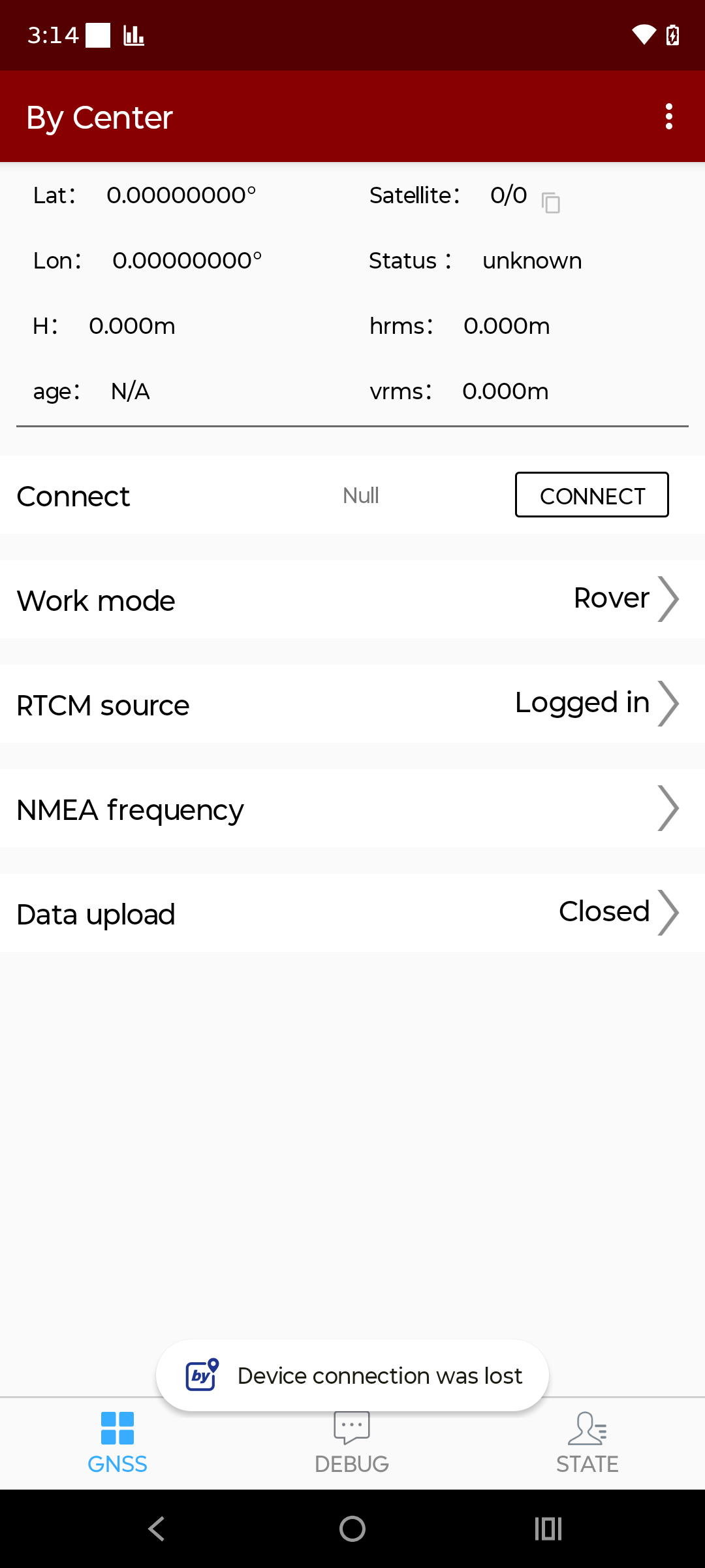
-
Click CONNECT and select the Bynav GPS, the name will start with BY80125
- Click NMEA frequency
- Set the messages frequencies as shown in the image
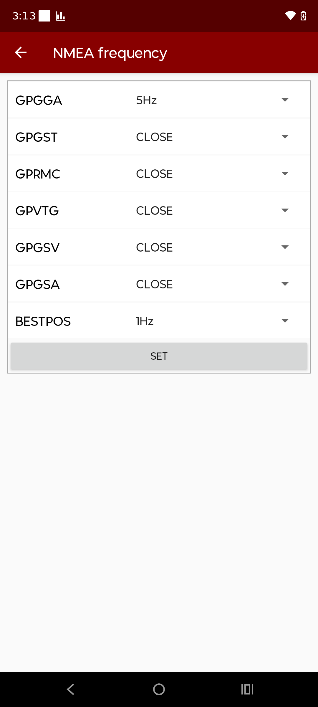
- Click SET to save the rates.
- Click the Back button in the top left, and disconnect from the GPS.
- Close the app and continue with surveying.
Enable BLE
To enable BLE on Bynav M8-X1, download ByConnect for Windows.